From the early 1400s southeastern Arizona has been home to the Chiricahua Apaches, some of whom lived in and around the Chiricahua Mountains.
They called this the "Land of Standing Up Rocks." They hunted and gathered edible plants, and fought relentlessly against the incursion of European settlers. Led by Cochise and Geronimo, they raided pioneer settlers, but were never able to stem the tide. In 1886 the Chiricahua Apaches surrendered and were settled on reservations in Oklahoma and New Mexico.
In 1888 Swedish immigrants Neil and Emma Erikson settled here.
By the 1920s their eldest daughter, lillian, and her husband, Ed Riggs, turned the homestead into a guest ranch.
From 1917 until 1973 visitors came to relax, watch birds, and hike in the hills.
We came to drive the scenic road, but I would come back to hike some of the trails. We couldn't this time because we had Thistle with us.
Bonita Canyon Drive winds 8 miles to Massai Point.
On the way there are several pullouts for viewing the rock formations.
Organ Pipe Formation
I thought this looked like a giant stone mushroom.
It took me awhile to "see" the Sea Captain.
The forests were badly damaged by fire in 2011.
Fresh snow on the mountains in the distance, but it is warm here.
Do you see the kissing rocks?
Kissing Rocks
The view from Massai Point. There is a 360 degree view of Rhyolllite Canyon, valleys and mountains from here.
The view from here reminds me a little of the hoodoos at Bryce Canyon, except the colors are different.
We walked part of the Rim Trail.
Birdie is remembering the last time she was here she was too short of breath to do this....much better shape today!
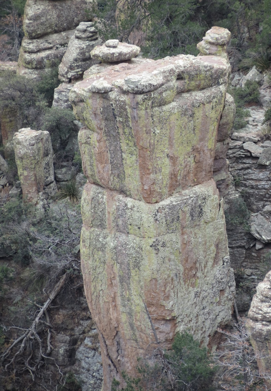
Colorful algae and stains on this column.
This looks at the view from the parking lot.
The hills are outlined by the burned trees.
On the way back to the campground we spotted this tumbleweed on the power pole. Guess it's been a little windy here.
The next day we visited another range of mountains, the Dragoons, home of Cochise and his band of Apaches.
The Dragoon Mountains
The road to Cochise Stronghold is primitive.
At the campground there is a short accessible trail that tells the history with interpretive signs.
The incident that started the war.
Cochise died in 1874 and is believed to be buried deep in a gorge, somewhere in these mountains.
Trailhead parking at the campground.
The Cochise Trail leads into the canyon and over the mountains to the west side. We hiked part way up and back.
Thistle is allowed on this trail.
Along the way it's easy to imagine Cochise and his soldiers keeping lookout from the rocky peaks, and finding many places to hide or ambush the enemies.
Huge boulders created shelters.
I was looking for the Indians in my mind's eye, but Birdie was probably looking for birds.
Some of the places I drag her to.
One of the reasons these mountains were a good place to live...springs.
Oh look, we saw and heard a few birds. This is a Mexican Jay.
A fortress better than any army fort in the area, for sure.


I love your imagination and all the pictures of the rocks....so many interesting formations. Thistle looks like he really enjoys hiking with you.
ReplyDelete