It started with a visit to the Loreto's Mission Museum. New Spain needed men to define and map the new territory of California. This royal decree gave the task to the Jesuits as not only priests to convert the natives, but explorers and mapmakers.
The first mission was established at Loreto in 1697, followed shortly by the mission of San Francisco Javier, about 22 miles away in the rugged mountains of the Sierra de la Giganta. It is said to be the best preserved mission in Baja.
It is believed that the native population was between 20 and 50 thousand people at the time the Jesuits arrived. They were nomads and survived by hunting, fishing and gathering fruits. The men were naked and the women wore skirts of small reeds strung together with agave string. During the years of the missions, the native population declined sharply due to introduction of European diseases, such as Smallpox and Yellow Fever. Eventually they died out completely, as there is no longer a native population of descendants.
Beth and I signed up for a trip to see the "Jewel of the Missions."
 Our guide picked us up with a van at our campground at Loreto Shores. These houses are for sale or rent...very pretty.
We start off heading for the mountains.
Our views were out windows that didn't open.
There are interesting stops along the way. The guide turned off the road to this dry wash for the first stop.
He said he was going to show us the wild pigs.
So we followed him. He was looking at the ground...I thought he was on their trail...
Oh, not wild pigs, but wild figs!
This amazing wild fig tree is over 300 years old. Its roots grow over and through the rock and appear at different places through the cracks. Do you see the root at the right?
Then he pointed out this plant....Jimson Weed. Hallucinogenic and very poisonous.
Back on the highway, the road gets rough. There was a bad storm (hurricane?) last October that caused major landslides, washing out the road in several places. It is under repair.
We are climbing higher into the mountains.
There are many places where water flows over the road.
We were glad we weren't trying to drive our RVs here.
The natives called this place "Vigge Biaundo," which means, "high lands in the heights of the ravine."
Painting on the rocks...not an old one. The native rock paintings that were on this route were covered by the landslides, so no longer part of the tour.
Really beautiful scenery if you're not driving.
Do you see our road up ahead?
Site of a large rockslide. The people of San Javier were cut off for three days before workers could get through.
The canyon where the rocks slid down.
Looking back from the road above.
Rock slide area.
I forget what kind of melon this is.
Animals eat them.
The view looking down on Loreto.
A small rancho.
Climbing...
Our road was rough, but not nearly as bad as the Jesuits who had to traverse these mountains on foot. One huge accomplishment was the Camino Real...the mission trail they built connecting all the missions in New Spain. A portion of the old trail can be seen from here.
El Camino Real, the King's Highway.
We stopped for a photo op....Red-tailed Hawk.
We passed the orchards, but didn't stop because they were closed. Date palms, guavas, citrus fruit, mangos and olives are among the trees in the orchard.
This little chapel was built for the workers in the orchard. The guide identified the native stones used in its construction.
We thought so, but we're not there yet.
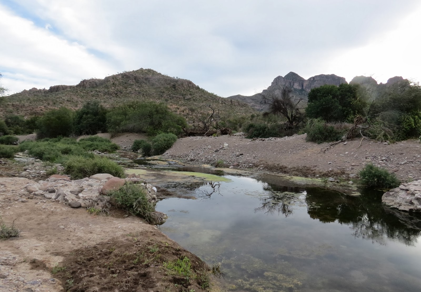
All the water is from springs. A good reason to locate the mission where they did.
Our guide stopped to show us another plant.
He called it wild tobacco. It is poisonous.
Then we took a little walk so he could show us some cactus fruit.
Marmalade is made from it.
If the birds don't eat it first.
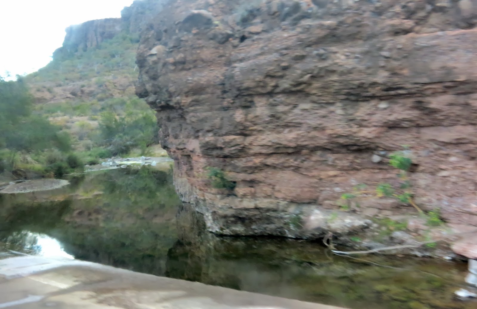
We walked down by the water.
The water is managed by a series of small dams and irrigation canals.
There are some birds here...Greater Yellowlegs.
Ducks....maybe Cinnamon Teal?
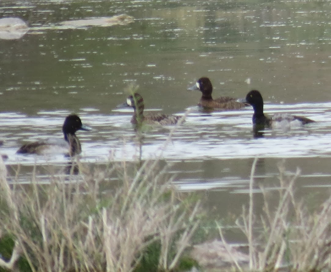
Most of these are Lesser Scaup, with a couple of waders at the bottom of the picture.
One of the small rock dams used to control water flow.
Lesser Scaup
They flew away...
But this duck didn't...maybe a Blue-winged Teal?
The juice of this plant was used by natives for paintings. The clear juice turns blood red when it dries.
Livestock is free range. It was the Jesuits who first introduced farming and livestock to the area.
Another stop, this time for a Harris's Hawk.
Harris's Hawk
Just a Turkey Vulture, but I love this shot of him with the sun shining through his feathers.
Finally we arrive at our destination!
This monument is known as the "Cross of Calvary," dating from the 1700s. On December 2, hundreds pilgrims come from far away for the Festivities of the Patron Saint. They start at the cross and walk on their knees all the way down the cobblestone street to the mission.
The mission was built of stone from a quarry in the bed of a nearby brook. Although the mission was established in 1699, this building was begun in 1744 and finished in 1759.
It is said to have the first weather vane in Baja.
And also the first glass windows. This is the original glass.
Symbol of the Jesuits over the door.
Ventilation holes help keep it cool inside.
The bell is dated 1761.
High threshhold...
Inside
On the left you can see where some paintings were stolen during the Revolution.
Outside, a small cemetery where a few important citizens from the early 1900s are buried.
A large ventilation hole.
Behind the mission are gardens and orchards. These are rows of onion and/or garlic.
We follow our guide through this gate to an old olive grove planted by the Jesuits about 300 years ago.
A magnificent, very old olive tree.
They irrigate today, just as they did back then.
Gravity does the job, no pumps are needed.
I can't remember what he called this red and black bean/seed.
He said they are used to make necklaces.
The back side of the mission. The mission was deserted by 1817. The church has been restored and is now maintained by Mexico’s National Institute of Anthropology and History.
Soldiers' quarters. Soldiers were subordinate to the missionaries who paid their salaries.
Stairway to the bell tower.
About 200 people live in San Javier today. Children live at the school during the week, and go home on weekends. The town just recently got its first cell service.
Fresh oranges on the trees.
Which means fresh-squeezed orange juice with lunch. Everything was locally grown and prepared...Beef burritos, goat cheese, beans.
This gentleman brought us fresh limes and tangerines to try. The limes were very sweet.
Olives from their olive grove...stronger taste than what we buy in jars.
The restaurant that provided us lunch as part of our tour.
San Javier hasn't had regular electricity very long. This is how they used to get electricity...only a few hours a day. Imagine the task of putting in poles and lines over those mountains and canyons.
Local arts and crafts for sale. I bought some Guava Marmalade. I'll let you know if I like it.
Iguanas are often seen along this wall...I didn't see any.
Back through the mountains...
A stop for another look at the old mission trail.
And a gorgeous view of Loreto.


I am so glad you got to go there - isn't it impressive what could be done so long ago in such an isolated place.
ReplyDelete